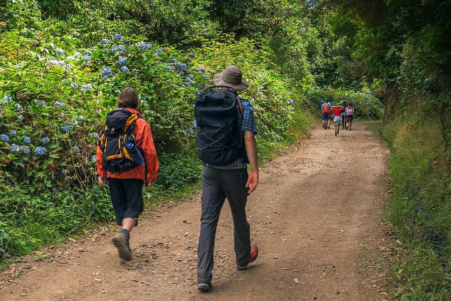
Vereda das Funduras, szlak przez las i punkty widokowe
OpenToday: good to goEast

PR 5

Vereda das Funduras

Portela - Maroços. Highlights: Portela, Funduras forest, Maroços.

ocean and cliffsLaurissilva forest
Distance
7.5 km
Time
about 2 h 30 min
Difficulty
Moderate
Fee
from 4.50 EUR
Altitude
186 - 624 m

Decision for today

Good to go

Status and basic weather do not show an obvious blocker. Still check IFCN/SIMplifica before starting.

  • Official status: open.
  • Weather: Good weather.

Watch this trail

Leave your e-mail and we will send a message when the official trail status changes. Perfect when you plan ahead.

Your address is used only for alerts about this trail; they may include labelled partner links. One click unsubscribes you.

Access and parking

Portela

guidance

Quick access check

Parking pointBus possible after checkingPlan the return
Parking / start

A one-way trail from Portela to Maroços. Plan your return from Maroços or Machico before you start.

Coordinates for navigation

Start32.74747, -16.82545
Finish32.73758, -16.79832

Enter them into an offline map or the car's navigation before you set off: on mountain roads the signal can drop out for long stretches.

Bus / transfer

Portela and Machico/Maroços are usually easiest to check via eastern Madeira connections.

Search in SIGA: Portela, Machico, Maroços.

Logistics

linear trail. Start: Portela. End: Maroços.

Access plan

By car

Portela. Set the start point in maps and check whether parking is available in the morning and afternoon.

Without a car

Search in SIGA: Portela, Machico, Maroços.

Return

This is a linear or logistically harder trail. Plan pickup, taxi or two transport legs.

Transport information is planning guidance. Confirm schedules, parking and access in official sources before you go.

Logistics tip. Confirm current departures, access restrictions and parking with SIGA or locally before heading out.

Trail map

Start point and area

Porto MonizSão VicenteSantanaMachicoFunchalPonta do Sol
PR 5

Orientation point

Portela - Maroços · start

This is an orientation point, not a full GPS trail.

Parking / access

Portela

A one-way trail from Portela to Maroços. Plan your return from Maroços or Machico before you start.

Elevation profile

181-623 m

Total ascent: 332 mTotal descent: 736 m
StartFinish

Indicative values: elevations read from a terrain model along the GPS track, not measured on the path. On rock ledges and near tunnels the model can show the slope above the trail.

EU-DEM 25 m · OpenStreetMap (ODbL)

Hike plan

Day plan for this trail

Hike

7.5 km · about 2 h 30 min · Moderate

Conditions

Good to go. Status and basic weather do not show an obvious blocker. Still check IFCN/SIMplifica before starting.

Checklists and timing

Before you go

  • Check the current IFCN notice for this trail.
  • Save the start point and route offline.
  • Book and check the fee in SIMplifica.
  • Compare weather with IPMA/ProCiv before starting.

Gear

Offline map / saved start

Signal in mountains and valleys can be unstable.

Water and snacks

Even shorter trails can take longer due to weather and stops.

Windproof layer

On ridges, cliffs and in gusts, wind chills quickly.

Sun protection

Ocean-side sections can be exposed and without shade.

Daylight

Estimated time: about 2 h 30 min. Latest reasonable start: 16:58 (45 min buffer before dark).

Data confidence

What is reliable and what to check

Trail status

IFCN live

Last read: 15/09/2026, 14:21.

Difficulty

official

Shown as official or consistent with the source label.

Map point

start

This is an orientation point, not a full GPS trail.

Access

guidance

Checked: 14/05/2026, 01:00. Confirm schedules in SIGA.

Weather now

Open-Meteo

Updated: 15/09/2026, 14:21. Refresh about every 1h.

Races in this area

Competitions are scheduled nearby on these dates. Expect closed access roads, full car parks or traffic on the trail itself.

  • 100 Milhas – Historic Rally

    10/10/26 · car rally

    machico

Dates from the regional events calendar; confirm with the organiser before you travel.

After the hike

Where to eat nearby

Bar e Restaurante Portela á Vista

Portela

4.6(627 reviews)Google Maps rating, checked on 25 July 2026

It stands on the Portela pass, exactly where the Levada do Furado ends. Espetada with a valley view and free parking. Note that it is closed two days each week.

Hours
Wednesday to Sunday 13:00 to 22:00, closed Monday and Tuesday
Prices
15 to 20
Cards:
accepted
Open in Google Maps

We checked the ratings and hours once, on the date shown, and this kind of data ages fast: confirm before you drive out. We have no agreement with these places and earn nothing on these tips.

Trail FAQ

Common questions before you go

Is the trail currently available?

Open. Trail status and weather can change quickly. Before you go, check IFCN, SIMplifica, IPMA/ProCiv and local signage.

How long does the hike take?

Roughly 2 h 30 min at a calm pace without longer breaks. Add time for photos and rest.

How much does entry cost?

Entry costs €4.50 for visitors over 12. Pay online in SIMplifica and keep the confirmation for checks.

Do I need to book or pay?

This trail requires booking or entry verification in SIMplifica before you start.

Where do I park and how do I get there?

Portela. Portela and Machico/Maroços are usually easiest to check via eastern Madeira connections.

Is this a good trail with a dog?

check dog rules. May be possible with a dog, but check current rules, weather and passages.

Trail profile

Who it suits and what to watch

Best for

Ocean trail exposed to wind and sun.

cliffs/ocean

With dog

check dog rules

May be possible with a dog, but check current rules, weather and passages.

Risks

  • On cliff trails, check wind, exposure and descent conditions.